Glacier Park Chat

Since we knew we wouldn't get on the trail as early as we liked, we decided to have a sight-seeing day. We had gotten pas_sports before we left, just in case. Today would be that "just in case" day.
We drove up the Chief Mountain Internatonal Highway (A really fancy name for a pretty narrow 2 lane paved road). The views were wonderful!
This is Chief Mountain.

After crossing through customs.. not as difficult as I expected......we continued on into Canada.
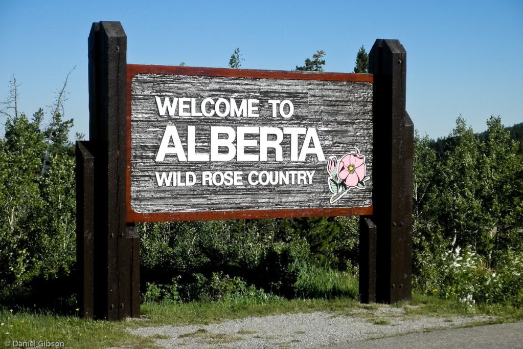
A couple from New Mexico had stopped at the same pullout. We exchanged cameras for pictures with the Alberta sign.

We stopped at the edge of Waterton Township at the Visitor Center. Although we weren't prepared for any long hikes, I had a book called "The Best Easy Dayhikes in Glacier and Waterton National Parks." I thought we could all do any hike listed in THAT book... and there was one that left right beside the visitor center/ranger station...Bear's Hump.
Here's how the book describes the hike:
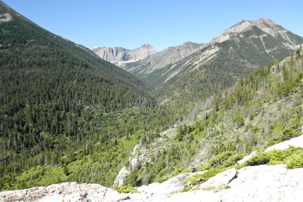
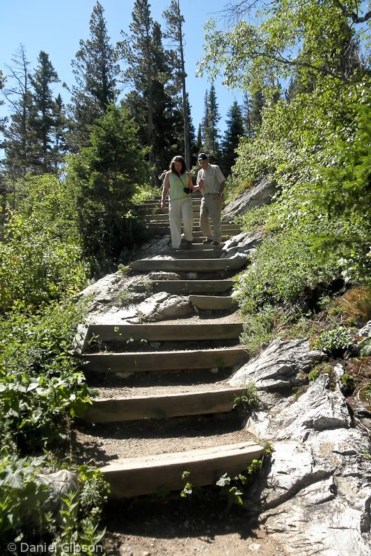
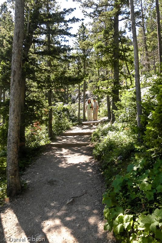
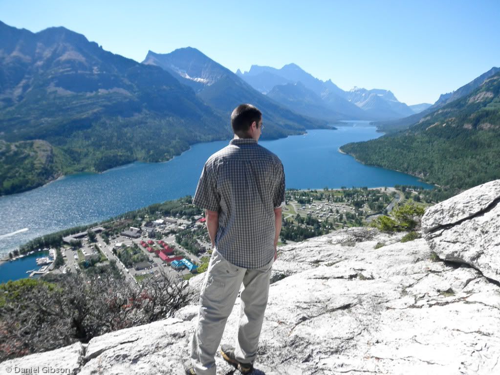
"This trail CLIMBS the mountain slopes to visit a spectabular overlook of Watrton Lake. The hike begins with a STEADY CLIMB through sparse woodlands of aspen and Douglas fir. Looking UPHILL, the twisted strata of Mount Crandall can be viewed through the trees. This mountain was orginally known as Bear Medicine Muontain by the Pikuni (Blackfoot) tribe, after the bear's hump appearance of the spur that the trail ASCENDS. After reaching the first bench, the CLIMB levels off a bit, then STEEPENS to a VERITABLE STAIRCASE UP the mountainside. The CLIMB INCREASES further after the second rest bench, and airial views of the Prince of Wales Hotel with its solitary spire can be seen to the south.
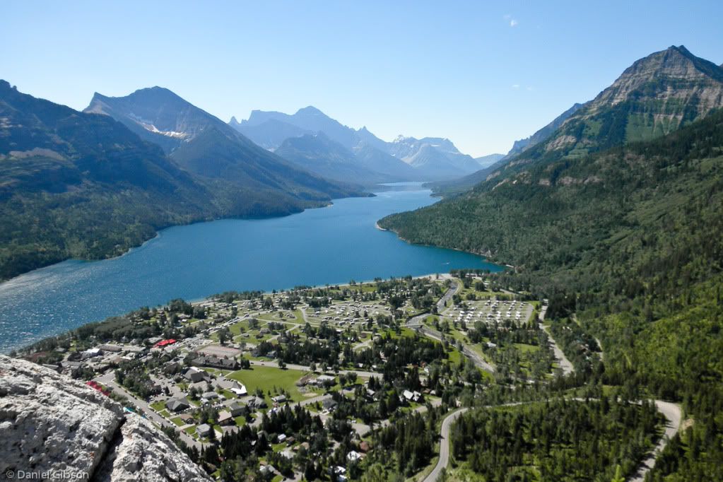
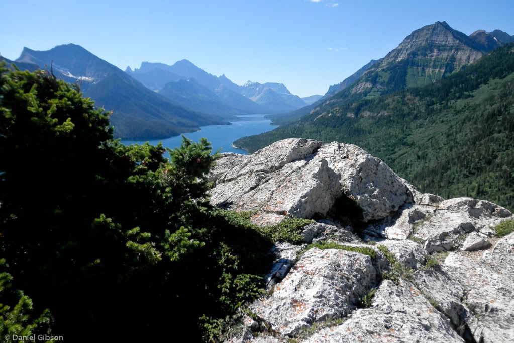
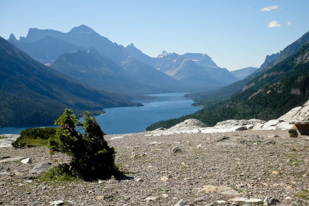
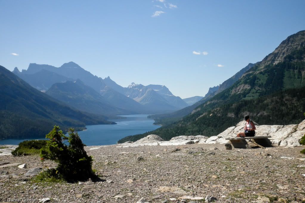
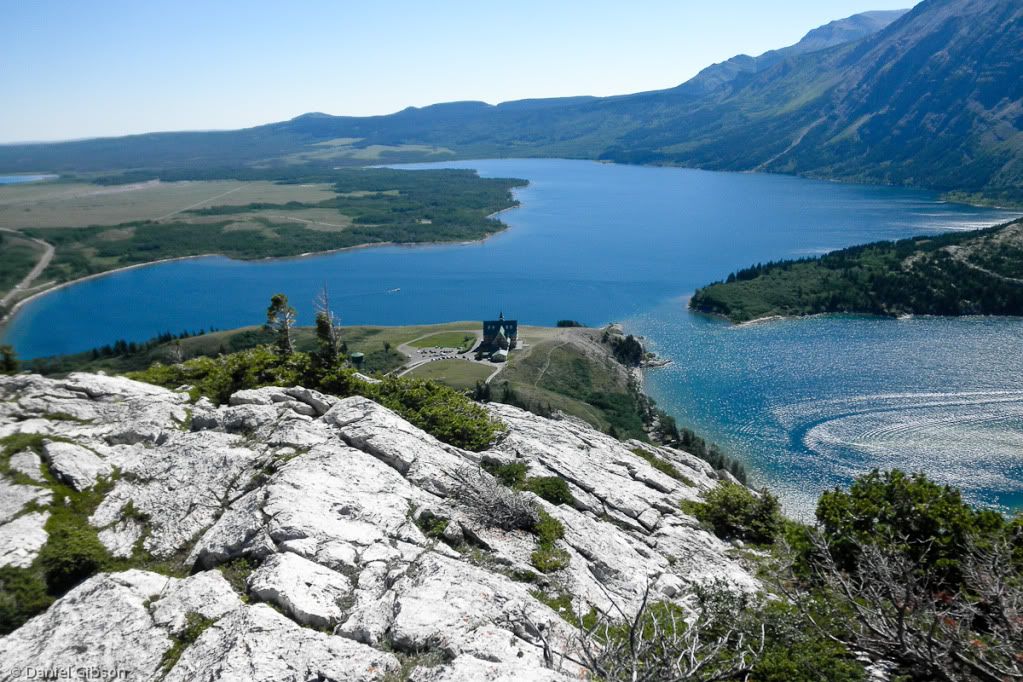
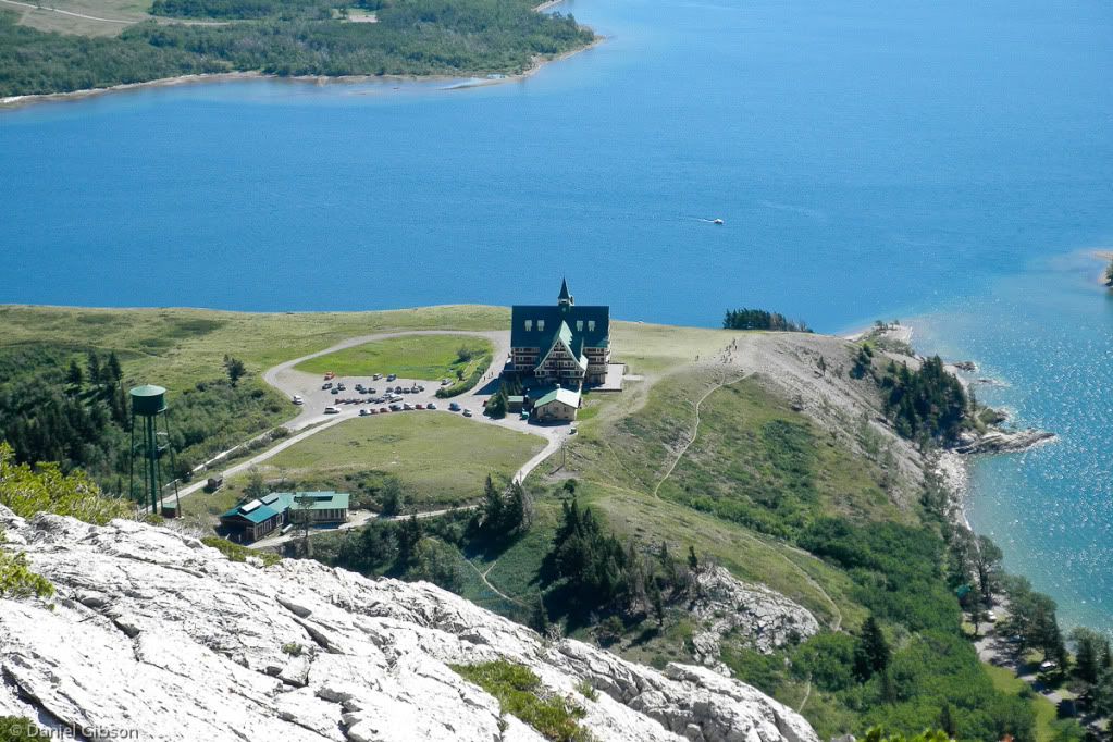
The CLIMB ends atop the rocky dome of the Bears Hump. Spectacular views stretch in all directions, hihglighted by the sapphire waters of Waterton Lake stretching southward into the United States. From north to south, the rugged crags rising above its far shore are Vimy Peak, Mount Boswell, and Mount Cleveland, which is the tallest summit in either national park at 10,446 feet. Mount Richard is the most priminent peak on the eastern shore of the lake, and in the distance is the jagged jawbone of the Citadel Peaks, known as the needles to the Pikuni people. Looking west, views up Carthew Creek feature the rocky summit of Buchanan Peak. And to the east, the Waterton River wanders out onto the verdant grasslands of the high plains."
*Emphasis added.
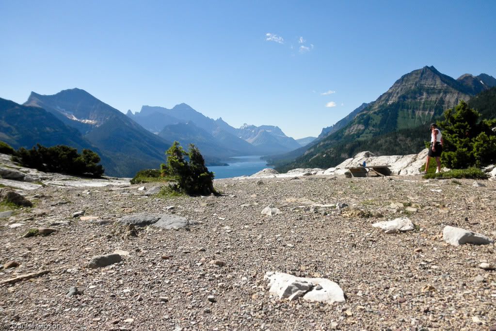
Translated... This thing is steep! This picture was taken just after the second rest bench, when I was strongly considering going back down without going all the way to the top. What kept me going was the boys who had reached the top and turned around. When they got back down to where we were, they both encouraged us to keep going. They said that the views were well worth the climb.
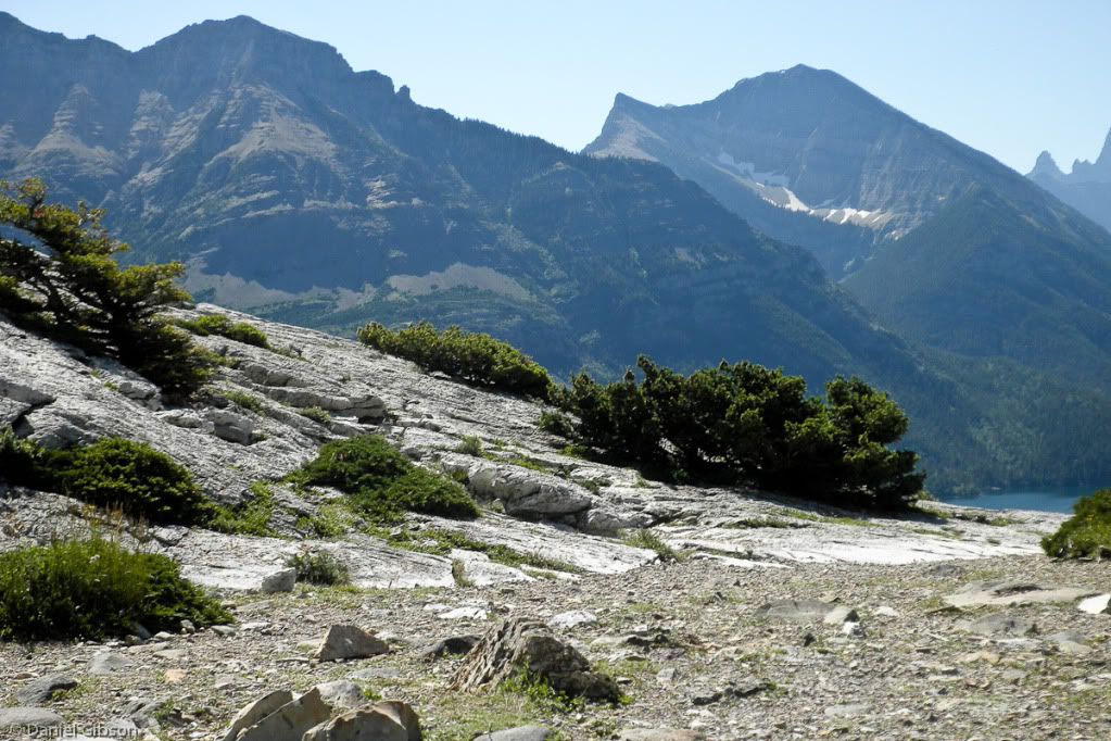
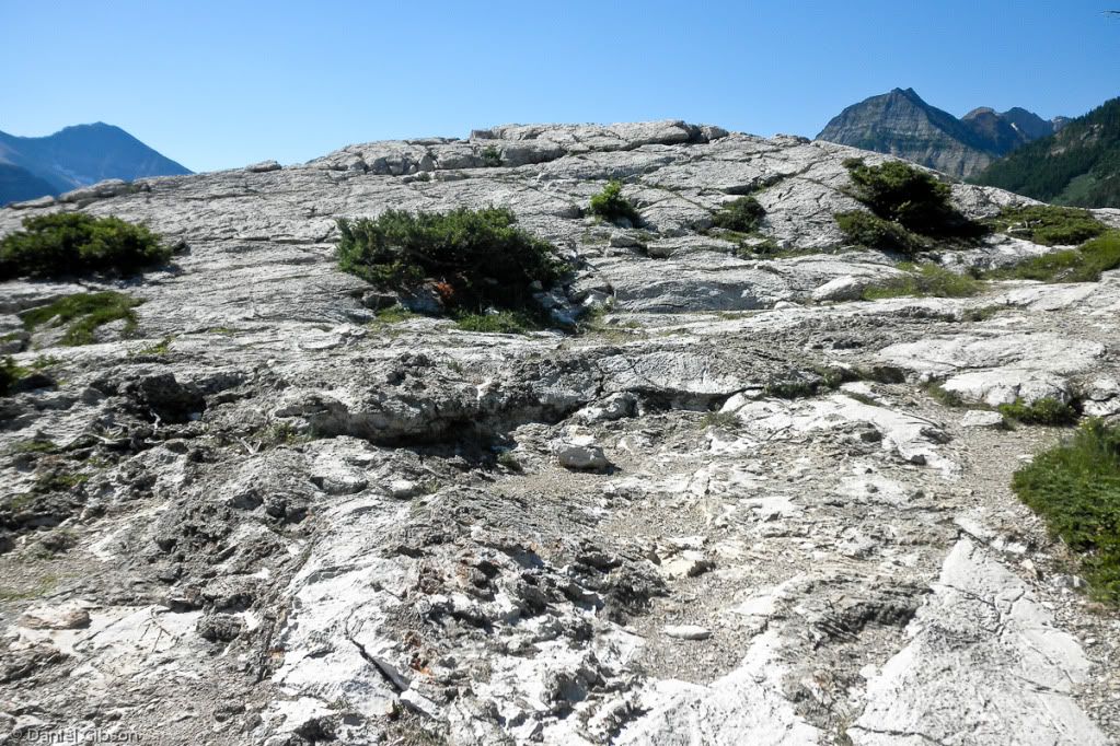
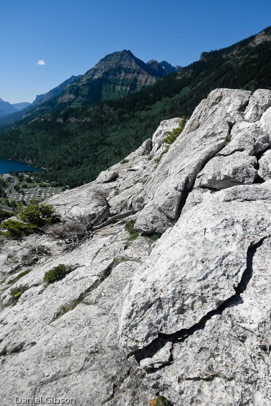
The rock at the top....
We didn't take many pictures on the way up... it was almost all in trees so there weren't many views, and it was a steady climb.
It was probably my LEAST favorite hike of the trip. No....it WAS my least favorite hike of the trip, no probably about it. The boys, on the other hand, say it was all worth the views from the top. Even with hiker's amnesia, I'm not so sure.
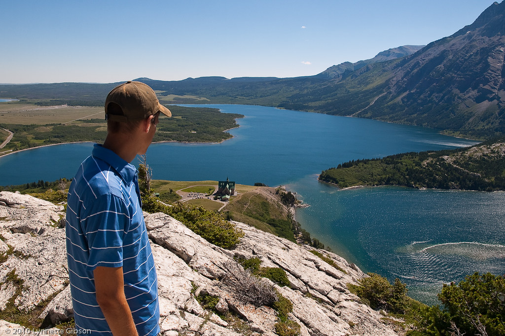
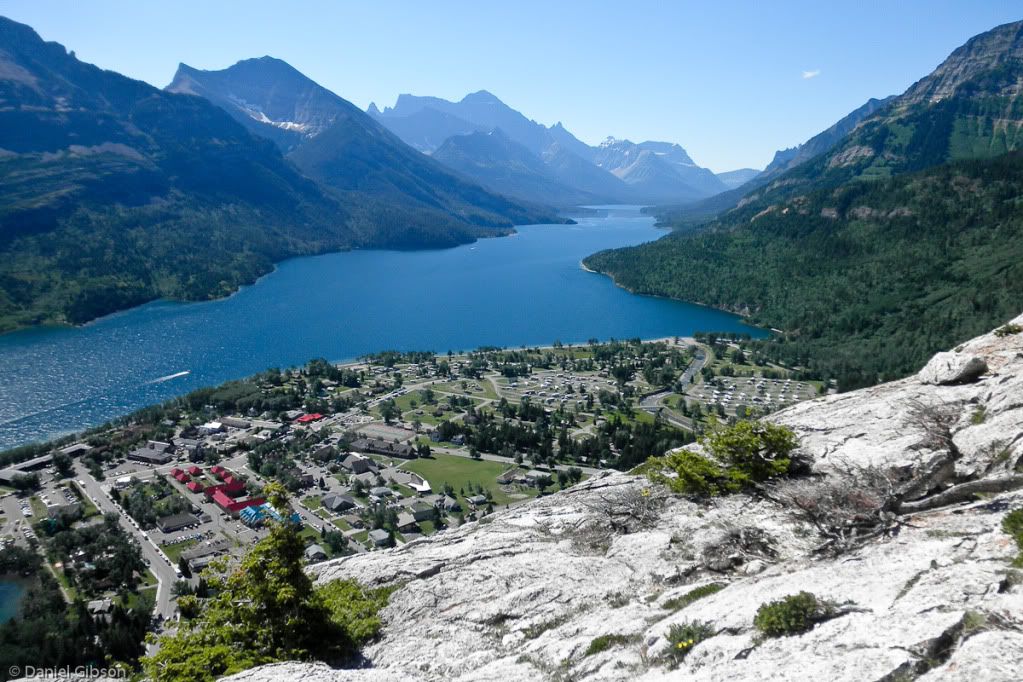
Joshua....looking down at Waterton Lake and Waterton Township.
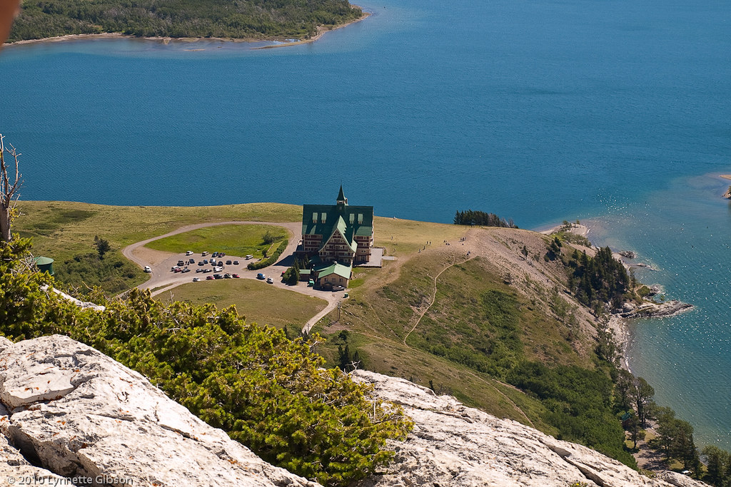
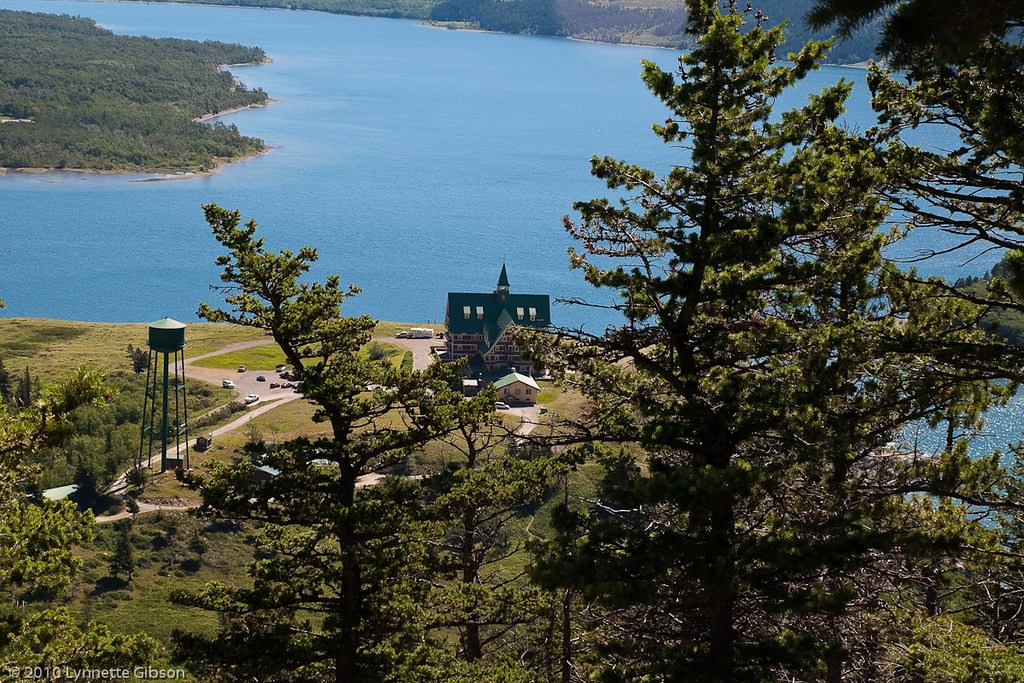
Prince of Wales Hotel and Waterton Lake
From up here, Waterton Township appeared to be mostly campgrounds, cabins, etc.
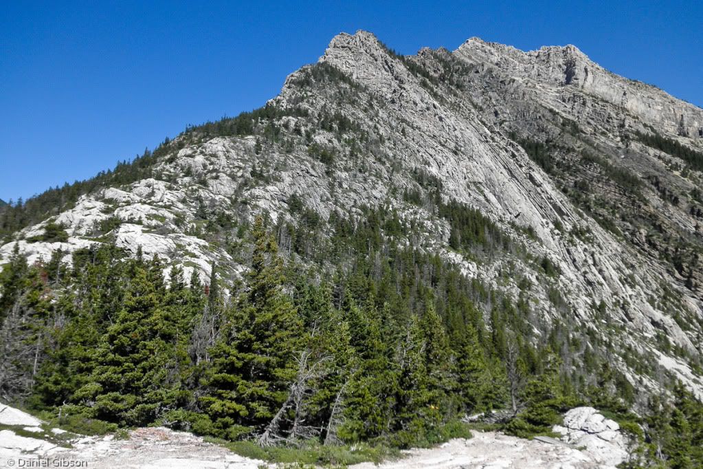
Mt. Crandall?
...ok...follow this:
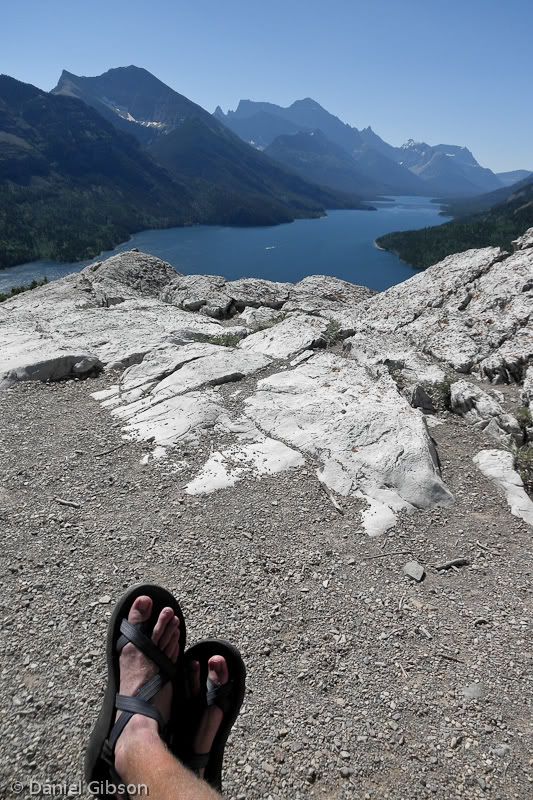
You climb 1000' of vertical elevation in a little over 3/4 of a mile...stand on top of the overlook... then use the zoom on the camera so it looks as if you are closer???
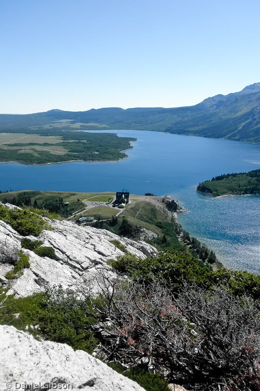
It was a little hazy... I bet on a clear day....