GNP 2023 - TSE to TNE (the long way)

Well, tell us how your trip went. We all want to hear about your special experience.

Moderators: teapot57, Tara

zozeppelin
Special Contributor
Special Contributor
Posts: 431
Joined: Sat Apr 06, 2019 5:53 pm
Gender?: Male
Please add the numbers(11): 11
Has thanked: 103 times
Been thanked: 59 times

GNP 2023 - TSE to TNE (the long way)

Post by zozeppelin »

Day -n

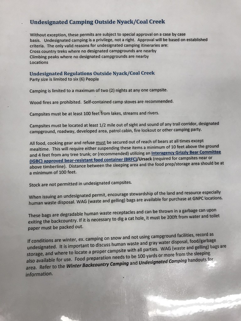
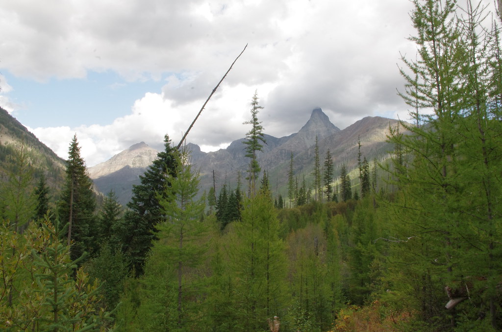
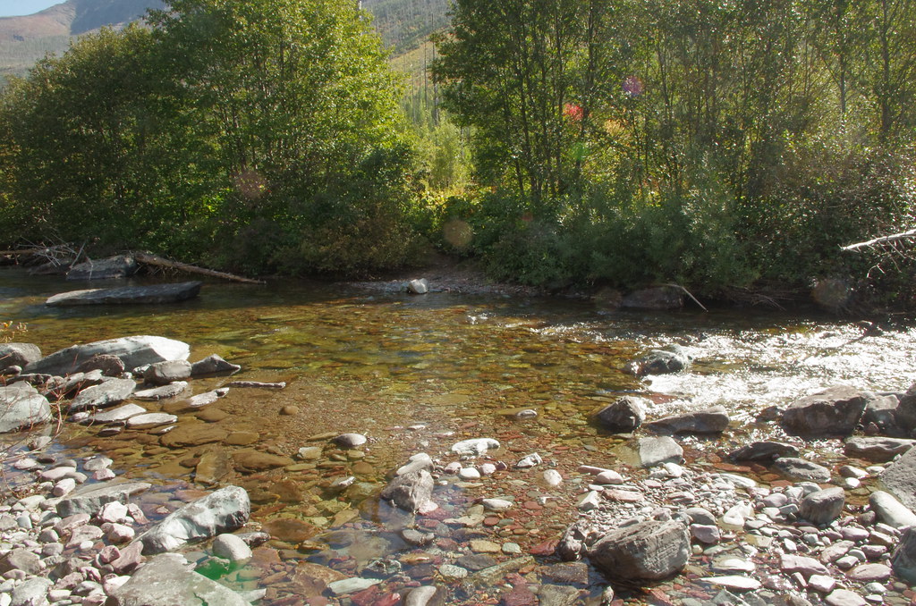
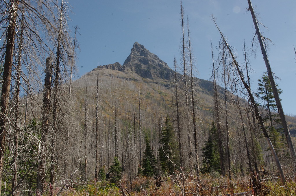
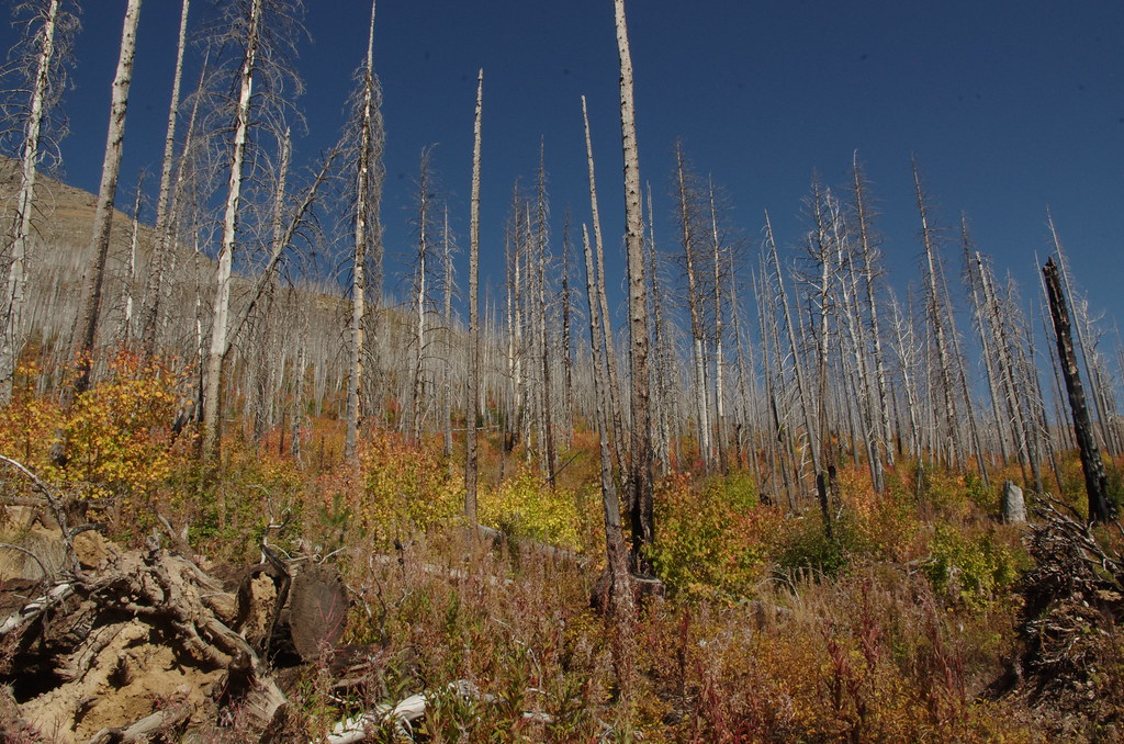
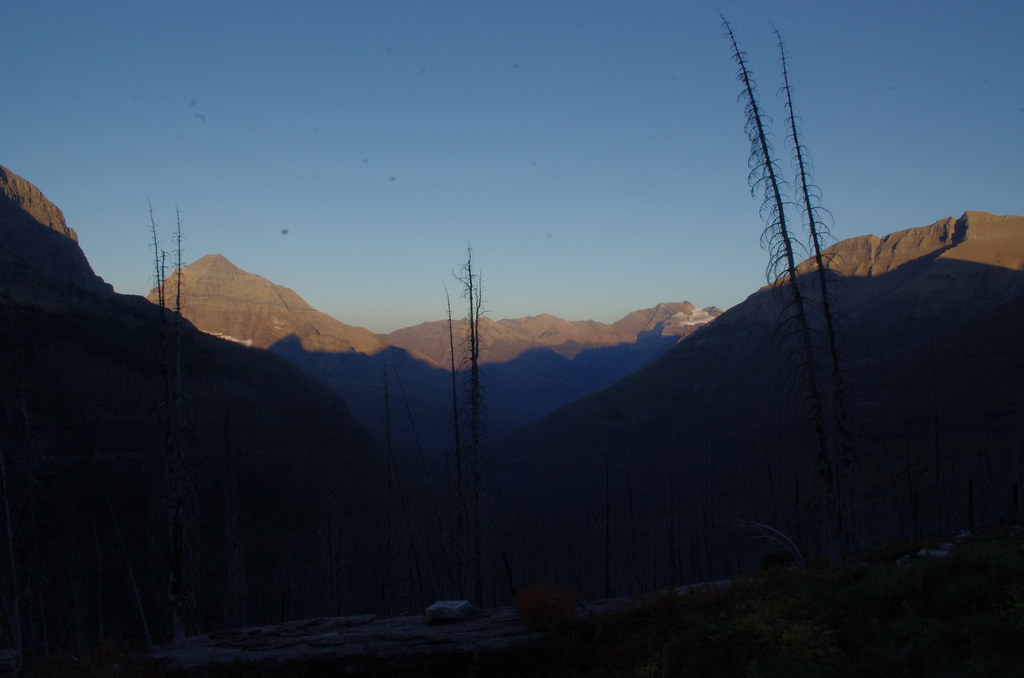
Finally getting around to the trip report. One of the last areas that I hadn't been to was the Nyack/Coal Creek area, so I wanted to give it a try to see what all the hubbub is about. It's framed out by GNP to be some land before time. Will there be dinosaurs? Cavemen? 5 star resort?

I also hadn't been on a solo hike in 5 years, so I wanted to to do that again as well.

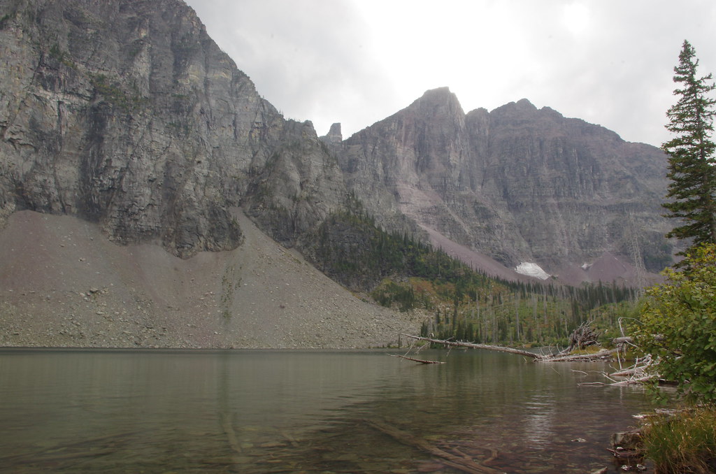
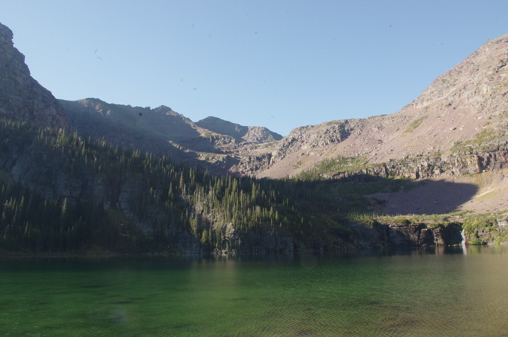
I'm a sucker for passes and ridge walks, and there are several in the Two Medicine area that I hadn't experienced yet. Second to that I'm a sucker for mountain lakes, with some attractive ones as well I hadn't seen (swam) before.

In 2020, I was trying to find a creative way to make a loop from Two Medicine, or really in reverse through Two Medicine as it was closed that year. My goal was to try and hit all 3 passes (well 5) in that area - Firebrand, Two Medicine, Pitamakan (+Cutbank + Dawson), but I couldn't quite figure it out as there were 3 in/outs (East Glacier, Two Medicine, Cutbank). I'll keep thinking on it (short of tearing up Dawson or going over Red Eagle Pass).

These things converged this year, as I was sure the area would be nice, but if I had company I would prefer to keep with some of the more popular areas. I had already had spent a week in the Tetons earlier this year, so I was short on vacation and goodwill, so this one was going to be tight on logistics.

I was able to snag a permit as desired on March 15th, 8 AM MDT, with the premature opening of the applications prior to it being shut down. Itinerary as follows:
TSE-COB-ISA-PAR-COA-BEA-OLD-TNE

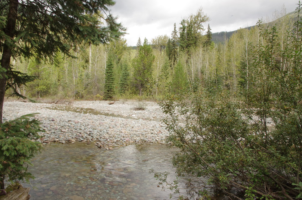
The intention was to hike back up from OLD and leave via the Pitamakan-Dawson ridge, as I hadn't done it counterclockwise before - if I had the legs of course. Most those days are easy to moderate, but with the unknown of the fordings (caulk the wagon?) and trail quality (is there a trail?), that was ok. There isn't much option as there aren't many extra sites.

I don't seem to have a record from rec.gov of the itinerary information, with distances and elevations, but here is what I was able to put together at the time:
From To Distance Gain Loss
TSE COB 5.7 1371 0
COB ISA 8.3 1879 2932
ISA PAR 9.7 0 1527
PAR COA 8.8 1900 2000
COA BEA 11 2000 0
BEA OLD 13.9 3000 2000
OLD TNE 11.9 1394 2841
zozeppelin
Special Contributor
Special Contributor
Posts: 431
Joined: Sat Apr 06, 2019 5:53 pm
Gender?: Male
Please add the numbers(11): 11
Has thanked: 103 times
Been thanked: 59 times

Re: GNP 2023 - TSE to TNE (the long way)

Post by zozeppelin »

Day 0

As I mentioned, I was running short on goodwill and vacation, so I attempted to squeeze this trip in as few days as possible.

Additionally, in the weeks leading up to the trip, the trail closed between Pitamakan Pass and Two Medicine (well really Dry Fork intersection). So that meant I had to take Pitamakan-Dawson to get out, which was the plan anyways, but I lost the campsite for the last night, so modifications were required. In the meantime, I had decided to try and squeeze down the trip into 5 nights instead of 6, thinking to consolidate in the Park/Coal/Nyack area.

So the thought became to try two nights in undesignated sites (a supposed feature of Nyack/Coal Creek area), by splitting the Isabell to Cut Bank Cutoff trail into 3 sections instead of 4:
Isabell to Fielding Trail midpoint (going past Park Creek)
Field Trail midpoint to Beaver Woman Lake
Beaver Woman Lake to Cutbank Pass cutoff midpoint (going past Nyack trail intersection)

If undesignated wasn't possible, then the thought was ISA-COA-BEA-UPN with a long day to COA and a little backtracking UPN.

Plan was to fly the morning of Day 0 (bright and early), land in Missoula (no cheap returns from Kalispell), then hustle up to the Apgar to pickup/modify the permit, then back to Kalispell for supplies. Backup was knowing Day 1 was going to be relative short so I could make it work even with a day delay and afternoon start.

All went well with the flights, rental car and drive. Once I reached the permit station, the ranger confirmed Pitamakan pass trail was still closed and explained the undesignated camping rules. Pictures are below, but essentially it is 'available' in the Nyack/Coal Creek area 'near' trail (50 yd), and 'possible' everywhere else much further off trail (1/2 mile). With the Fielding Trail not technically in Nyack/Coal Creek area, that didn't work as I figured it would just be easier to hike into Coal Creek campground on trail. The second undesignated request was doable, and saved at least 2.7 mi backtrack to Nyack and gained some distance and elevation for the final day, which of course had a evening flight to catch out of Missoula.

And of course, as if things weren't tight enough, I injured my big toe the day before the flight slipping down the stairs and jamming it backwards. I thought I broke it due to the tenderness, swelling and bruising, but it didn't hurt bloody murder to press on the bones so 'checked out' as a 'soft tissue issue' by the biased doctor (myself). At best a constant limp and at worse a misstep unpleasant tweak reminder, but it was worth it. Finally starting to feel better 2 months later.

Final Permit (garmin in parenthesis). Unfortunately the permit printout format has changed, presumably with rec.gov update, such that the segment information isn't available, so I don't have official numbers for even the standard segments after the changes.
From To Distance Gain Loss
TSE COB 5.7 (6.3) 1371 (1847) 0 (300)
COB ISA 8.3 (9.1) 1879 (2451) 2932 (3307)
ISA COA 18.5 (19.7) 1900 (3035) 3527 (4741)
COA BEA 11 (10.9) 2000 (2989) 0 (965)
BEA Cutbank Spur (11.8 ) (1877) (2201)
Cutbank Spur TNE (14.7) (3499) (3773)
Image

Image
Last edited by zozeppelin on Sat Nov 04, 2023 5:30 pm, edited 1 time in total.
zozeppelin
Special Contributor
Special Contributor
Posts: 431
Joined: Sat Apr 06, 2019 5:53 pm
Gender?: Male
Please add the numbers(11): 11
Has thanked: 103 times
Been thanked: 59 times

Re: GNP 2023 - TSE to TNE (the long way)

Post by zozeppelin »

Day 1
9-11-2023 - COB- Cobalt Lake
Fires; NO
Segment; Length 5.7 (6.3)
Elevation; Up 1371 (1847) | 0 (300)
Bear locker: no

Ok finally some hiking! So I started the day wanting to try out the Sharing Shack for some bear spray on the way into the park, as I always buy but never use (a good problem, but I digress). I struck out there, so backtracked to Super1 and then onward towards West Glacier. Sept 11 was the first day without ticketed entry, and also a holiday as I understand it for some, so the line to enter the park backed up onto highway 2 prior to the turn. I waited there for maybe 15 minutes not making much progress, knowing a much longer line awaiting heading into Apgar, so I bailed. I did have a short first day, but with the injury I wanted to take it slow. I didn't need to take GttSR, but wanted to as I knew I wouldn't on the way out.

From the entrance the day prior (long line due to long processing times at the entrance windows), I have come to the conclusion there needs to be a 'documents in order line' where people can 'scan, scan, and go' with ticketed entry and park entry bar codes - automated even. This of course would require a 2nd lane for a longer portion of the drive in, likely all the way back to highway 2. This hot take of course isn't applicable anymore as the ticketed entry was pushed further down the road. And ticketed entry wasn't active for the long line, so that didn't even matter. Long gripe short, people shouldn't be taking several minutes each at the entrance stations, if they're going to, take care of that in a different line. Oh that and there are 1000 better things for rangers to be doing than babysitting this process.

So anyways, Highway 2 was uneventful and arrived Two Medicine, without any line and no issue finding a parking spot. I checked in with the backcountry office there on the outside chance Oldman and/or the Pitamakan pass trail opened. The lady there was tried but was in way over her head. Then started giving me the business about my permit, to the point of I had to reassure her I was just curious/confirming any updates and had no issues with my permit as issued, sheesh. Ok so with that confirmed, headed back to East Glacier for a final burger and cell service to send off confirmations. Then returned, parked the car at the North Shore Trailhead, and started walking towards the South Shore Trailhead.

Requisite starting picture:
Image

So I'm gingering along the road and then into the main parking load by the boat dock and store (closed for the season). As I walked by I saw 'junior' ranger directing traffic parking around the store and restroom area. I had my sun hoody up so I was pretty narrow sited and focusing on my steps/toe. At any rate about halfway down the parking lot towards the trailhead, people at their cars start telling me the ranger is calling for me to stop. So I turn around and junior ranger is running after me, and is now joined by other junior ranger, as if they have 'a runner'. So she asks me where I'm going and what I'm doing. I told her my first night and she asked to see my permit. I gave her the look and said 'really? it's buried in my pack, why would I lie?'. Then I got lectured about 'all the rangers in the backcountry I'll cross paths with that will also check my permit'. I was so shocked at the barney fife routine in the parking lot of all places I just took off my pack and pulled it out, then only got an 'ok'. Other Junior ranger told me they have people lie to them all the time. Looking back on it, I wish I just would have said none of their business as I don't need a permit to hike, especially in the parking lot, and if they wanted to check where I was sleeping more power to them to come out and do that. In the several hundred miles I've logged in the backcountry, I've crossed paths with 0 rangers. Getting off my soap box, the Two Medicine rangers leave a lot to be desired.

So onto actual hiking. I warmed up ok focusing on my steps and limping along. First (and only) wildlife spotting while crossing a creek, I was on the bridge and along came a moose crossing below me.

Image

There was a family of 6 I was keeping pace with, youngest was 9 I think, really cool We split paths around Rockwell Falls.

Image

So then the last final couple miles up to Cobalt Lake. Cobalt Lake just sounds like a like I'd like to visit given the name and the color implication. It was a bit overcast and the the lake is tucked up against the wall, such that no good pictures. Here is one (also not good, but better) of the outflow, looking up towards where I thought I was heading the next day (Two Medicine Pass), which was half-correct.

Image

Cobalt Lake has 2 sites, so I was thinking flip a coin whether I'd see anyone there. Upon arriving I found two groups, so I began thinking 'oh here we go'. Turns out one of the groups was meant to go to Isabell (from Upper Two Medicine) but one of the hikers (college aged) ran out of energy(?) So they ended up staying exactly where the sign told them not to camp. I arrived too late / wasn't in the mood for a dip, so got on with the normal routine. The lake is not visible from the camping sites nor food prep area, which is unfortunate. But all and all, a nice hike and a nice camp.
Last edited by zozeppelin on Sat Nov 11, 2023 6:15 pm, edited 1 time in total.
zozeppelin
Special Contributor
Special Contributor
Posts: 431
Joined: Sat Apr 06, 2019 5:53 pm
Gender?: Male
Please add the numbers(11): 11
Has thanked: 103 times
Been thanked: 59 times

Re: GNP 2023 - TSE to TNE (the long way)

Post by zozeppelin »

Day 2
9-12-2023 - ISA- Lake Isabel
Fires; YES
Segment; Length 8.3 (9.1)
Elevation; Up 1879 (2451) | 2932 (3307)
Bear locker: no

With the previous day's drama behind me, time for some nice hiking. I was looking forward to Isabel as well, as if it was worth a spur trail, it probably was really nice (thinking Mokawanis). I didn't think too much of the hike as it was simply an up, over and down, or so I thought. It should have raised some red flags that the distance being quite longer than the topo would suggest as the crow flies, there would be a bunch of meandering.

And of course, it wouldn't be 2023 if it didn't start raining once I finished breakfast. So I had a bit of a late start trying to wait out the rain a bit as the day was relatively short. The rain wasn't bad, it was just more wanting clear skies for better viewing. Eventually I gave up on that and off I went. I reached what I thought was the pass fairly quickly (low spot on picture from previous day next to Mt Rockwell). It offered a nice view back into Two Medicine, as well as down Park Creek with the really cool mountains bordering Coal Creek (Vigil Peak / Battlement and Church Butte).

Looking back:
Image

Looking towards Lake Isabel, with unnamed lake behind!
Image

So instead of dropping down to the lake (which would have cliffed out looking back later), you head towards Grizzly Mountain on a ridgewalk!
Image

About halfway there, you pass over Painted Teepe Peak (ridge), which was the backwall to Cobalt Lake.
Image

Looking down on Cobalt:
Image

On the other side of Painted Tepee Peak (ridge) there is Paradise Park (who knew?). I believe I had read somewhere there used to be a trail up to it from the South Shore Trail.
Image

Eventually arrived to the slopes of Grizzly Mountain, and start switchbacks down to Park Creek, passing an unnamed Lake. There also appeared to be a goat/climber's trail up Grizzly Mountain.
Image

Great views continue, I believe this is St Nicholas popping up in the background.
Image

Looking further east towards Rockwell and from whence I came. I believe that is Cloudcroft Peaks and Eaglehead in the background. Now, in the valleys besides Isaball, there are also lakes, with names: Striped Elk on the left (North/West) on the other side of Battlement Mountain (to which Isabell abuts) and Aurice off of Rockwell.
Image

Then some downhill finally arriving at Park Creek (Upper), which seemed like a pretty nice campground with the food prep area right on the creek. I had a quick lunch there.
Image

Then a couple more miles to Lake Isabel.
Image

The campsite was really nice. Only two spots again, so I figured flip a coin at best if someone would be there. When I arrived it was vacant and i still hadn't seen anyone all day after Cobalt, which was nice.
Image

A little silty but I was able to take a dip, so that was also nice, and soak my feet for a bit, which always helps.
Image

The next day would be the big day, so I wasn't feeling too adventurous, but had I more time and/or companion, exploring up to the higher lake would have been cool. And the wall behind looked like it could be approached from the right (south) side slope.
Image

Eventually another hiker would show up, having started from Upper Two Medicine and having run into 'moose delays'. He had a cool story about being between jobs and was taking some time off to see the country via Amtrak. He arrived East Glacier, saw Glacier Park Trading Company was in the need of a cook, so he spent the summer working several days in a row, then hiking several days in a row. #jealous

All in all, a great day. The ridge walk was a very pleasant surprise along with the views of the mountains across Park Creek.
Last edited by zozeppelin on Sun Nov 12, 2023 1:42 pm, edited 1 time in total.
zozeppelin
Special Contributor
Special Contributor
Posts: 431
Joined: Sat Apr 06, 2019 5:53 pm
Gender?: Male
Please add the numbers(11): 11
Has thanked: 103 times
Been thanked: 59 times

Re: GNP 2023 - TSE to TNE (the long way)

Post by zozeppelin »

Day 3
9-13-2023 - COA - Coal Creek
Fires; YES
Segment; Length 18.5 (19.7)
Elevation; Up 1900 (3035) | 3527 (4741)
Bear locker: no

Ah finally the big day. Honestly I wasn't too worried about the distance, just the energy and Fielding Trail being too bushy. I also knew the water crossings would slow me down as I detest wet feet (bad blister memories), so that means shoes off crossings followed by drying - an achilleas heel of sorts, literally. I'm not a 'look at me' person, and the reason I started doing this trip reports was to try and help provide some information on conditions to enable someone who was on the ledge be more informed and go for it - oh and pictures and laughter are nice. Specifically for the next couple segments, there were going to be many creek crossings, but I never could find pictures of how bad (deep, long) they were - so that is what I'm going to try and document here. I figured this late in the year they would be pretty tame (low), but who knows with the currents, so I had no clue what to expect. Interesting side note is that the GNP map and National Geographic maps show different #s and locations of fords.

So onto the hiking, well embarrassing confession time first. I was a bit anxious to start the day so I woke up early and started prior to sunrise. Tent tore down fine, retrieved my food bags (2). I went to pull my rope down and it didn't come nicely, which I then noticed it was twisted. I have two bags with some really skinny ultraglide rope, so I like to hang the bags with the opposite ends to help with my paranoia around putting too much tension on the rope. So of course impatient me decided to just pull in through, not thinking much of it. Well of course it pulled tight. Decision was made to test shimmy up the pole to see if I could reach the knot - answer was no. Ugg, off to make breakfast and think about how to remedy. After breakfast made one more attempt and brought the knife. Couldn't reach the knot, but was able to cut it pretty high, losing about 5 feet of rope. Hall of shame material right there.

Image

It's about 10 miles from Isabel to Park Creek. My goal was to make it there in 4 hours, ford park creek and have lunch. That went extremely well. For the first time all hike I started to feel good, may have been just psychological though leaving the crime scene. Park creek is a highway, and a mildly downhill one at that, so I was able to hit the the 4 hour mark. I ran across a trail crew, who were going to be installing some boards to make a bridge (?) that I saw discarded uptrail about 1/2 mile before running into them. They appeared to be camped out at Park creek. More ranger cabin pictures:

Image

So first 'ford', Park Creek. Not crossable / jumpable so shoes off according to plan. There was a second section after the island, but it was no big deal either. You can tell this is pretty large early season given the river bed size. I came with the question of why don't they just put up bridges to make the area more accessible to help with the overcrowding, but now I realize these would be very large bridges and hard to maintain / not worth it due to the quantity required.

Image

Lunch and then up-down-up-down Fielding trail. Fielding was pretty dense forest until the end of the second climb where you get in the burn area. There was a meadow right in the middle of Fielding trail, after the Muir creek - which was crossable with hiking poles/rocks (no picture). It looked like the trail crew had been there. Not too many views until the second climb. I of course ran out of water right after Park Creek, so that slowed things down around Muir Creek. Finally started to get some views on the climb over Mt Nichols pass/saddle/not sure what to call it. I don't know what it was, but the hue of green on the pine(?) trees with the juxtaposition of the burnt trees still standing, was pretty awesome. The new growth made almost like a green desert floor.

Image

Finally popped over the crest and could see the Coal Creek Valley - a well needed source of energy.

Image

Image

Image

The descent seemed to take forever. One ford of Coal Creek.

Image

And surprise, one ford to enter the campsite, whomp whomp whomp. The picture quality adequately captures the 'care factor' at that point.

Image

So up to that point, only had crossed the two trail crew that day. There were two people in camp when I arrived. I hung my bags, setup camp, etc. I went back to go to the bathroom and then get water, and noticed the one guy had a handgun sitting on the bench. Not trying to make it political, just sharing my experience. I ran into someone with a gun two years ago at No Name Lake, and it struck me as strange, so I looked into it. It turns out one is able to lawfully carry a handgun in National Park area, but not use it, so that really stuck with me as to why would someone bring something that is illegal to use to potentially harmful? Rhetorical question aside, I had a long day so I let out a 'you know it's illegal to discharge your firearm' like an idiot. That didn't land really well, which then transitioned into 'have you heard me discharge it, all gun owners are responsible and know that, right to carry, etc etc.' So they ran off smoking I think, I made dinner and went to bed. I legitimately think one of them has tourette syndrome. Never a dull moment. A long day and a good day, not without some self-inflicted wounds. Leave it with some good thoughts:

Image
Last edited by zozeppelin on Sat Nov 18, 2023 8:52 am, edited 3 times in total.
zozeppelin
Special Contributor
Special Contributor
Posts: 431
Joined: Sat Apr 06, 2019 5:53 pm
Gender?: Male
Please add the numbers(11): 11
Has thanked: 103 times
Been thanked: 59 times

Re: GNP 2023 - TSE to TNE (the long way)

Post by zozeppelin »

Day 4
9-14-2023 - BEA- Beaver Woman
Fires; YES
Segment; Length 11 (10.9)
Elevation; Up 2000 (2989) | 0 (965)
Bear locker: no

Ok, finally 'in the Nyack'! Well, technically 'in the Coal' but that doesn't as cool. No dinosaurs to be found, at least the Jurassic variety. I was awoken to wolf howls. I slept in a bit from the long day prior and the relatively short day ahead, but was a bit apprehensive knowing with the unknowns of the creek crossings. Both national geographic (link) and GNP (link) and older (link) show 4 fords, but they are in different spots, and neither include Elk Creek, which was the one just prior to camp. The most confusing one to me was the double crossing within a half mile about half-way to the Beaver Woman spur trail.

I hadn't mentioned the weather for the last couple days, as it was great. A bit overcast and slightly cool, but good. One 'first world problem' most days was a ton of condensation on my tent, which resulted in the no-win game of packing wet or trying to dry out but failing. After my 'good mornings' and 'have a good one' were left unacknowledged, I was off. The march was pretty much directly into the sun, which was suboptimal for views, both illumination and just looking right at the sun. But there were some nice views of Cloudcroft peaks

Image

and Mt St Nichols.

Image

'Pass' between Mt Caper and Phillips that I mentioned earlier, with Lone Walker behind. This really caught my attention and curiosity.

Image

So I kept hiking, anticipating the first crossing a couple miles out, but it never came. Then the dual crossing a couple miles later, and it never came. At one point I heard a large sharp 'crack' and echo from behind (towards North Fork in the rough direction of the camp site). I didn't think too much of it at the time beyond just being loud for being presumably so far away as nothing was visibly obvious around and no secondary sounds. Thinking later on in the next day or two, I was left suspecting my two buddies. Eventually there was the crossing about 3/4 of the way to the Martha's Basin junction (6 miles?).

Image

Looking back on Cloudcroft Peaks with the tree circle of life:

Image

From here you turn the corner towards surprise pass. One last look at the saddle with Lone Walker behind:

Image

So onto Surprise Pass (not really pictured, it's to the right and Martha's basin is to the left) with Stimson hidden behind PInchot.

Image

Last crossing of Coal Creek (hurray!)

Image

This is the basin between Peril and Cloudcroft, Matha's is next.

Image

This is looking back one last time. The saddle is on the left, then Caper then Battlement. Between those two is where Isabell is. There looks to be a nice gully on the left, but that isn't the same spot where it looked accessible from Isabel, which is further right, right before the ridge starts ascending to Battlement. The picture cuts off some of that approach so hard to say, but doesn't look great from my untrained eye but not impossible.

Image

Made it!

Image

Setup camp, took a dip, etc. In a feel good moment, there were multiple cut ropes on the food hang, confirming I'm not the only person out here making rookie moves. Let's just say I'm very careful from now on that nothing is tangled prior to pulling. Didn't see anyone all day and no one at camp, well except these guys.

Image

This I believe is Mt Morgan and Red Mountain (corrections appreciated).

Image

Camp was pretty nice, but not 'on the lake'. Water was a little confusing as you could either go down to the lake (a jaunt), or scramble down to a creek right outside the tent. Phillips with a nice sunset on the with the black band (lava?).

Image
Last edited by zozeppelin on Sat Nov 18, 2023 11:14 am, edited 1 time in total.
zozeppelin
Special Contributor
Special Contributor
Posts: 431
Joined: Sat Apr 06, 2019 5:53 pm
Gender?: Male
Please add the numbers(11): 11
Has thanked: 103 times
Been thanked: 59 times

Re: GNP 2023 - TSE to TNE (the long way)

Post by zozeppelin »

Day 5
9-15-2023 - Undesignated!
Fires; NO
Segment; Length (11.8)
Elevation; Up (1877) | Down (2201)
Bear locker: no

Welcome to the adventure day with undesignated camping. I was more thinking / focused on that location, assuming the day would be like the previous meandering along the creek with some descent views - wrong! This was probably the most pleasant surprise of the days as I didn't have much expectation at all. So the plan for the day was a couple more stream crossings and find a suitable place to camp overnight. National Geographic said 1 crossing, and both NPS maps showed 2. I didn't think too much of them since I was closer to the headwaters so I figured they'd be weaker. The target for the day was the last water access, which as far as I could tell was prior to the big turn southwards towards Cut Bank Pass (NPS shows none/after, Nat Geo shows before and Caltopo shows before, so I assumed before).

Goodmorning, from the tent:
Image

Last goodbye to Beaver Woman.
Image

Figured I'd have time today, so wandered down to Buffalo Woman.
Image

Look over surprise pass.
Image

It's hard to describe, as well as capture well with pictures (at least for me), but the entire day after the pass was surreal. Everything was burnt, but there was colorful undergrowth and good views beyond.
Image

First stream crossing and I finally broke out the poles. It was a slab floor at an angle, so I didn't want to mess around as traction wasn't great. I of course didn't take a picture of that part, only the downstream.
Image

Meandered down a bit and hit the second stream crossing:
Image

I believe this is Tinkham
Image

Finally seeing down the Nyack drainage to Pumpelly Glacier:
Image

This one I jumped if I recall correctly.
Image

Pumpelly and Stimson:
Image

The foreground on these was so cool.
Image

Image

Image

This is looking up towards Tikham / McClintok saddles, which is a false pass of sorts, but would be foreshadowing for the next day:
Image

You can see the canyon there, that was the creek. I kept hiking as long as I could hear it. Eventually it died down and I crossed a very small trickle, assuming there was more to come. About 1/4 mile later still nothing and no signs of the stream from the canyon, so I started backtracking. With all the burn, it was fairly easy to see reasonable areas. In fact, it was all pretty flat, with some larger mounds here and there. But it was a challenge to find a spot that didn't have small hummocks from the plants. So I went off trail and searched for a bit, and found something reasonable. Thankfully I had a small tent. I left my bear bag away from camp, setup, and then started wandering back towards the stream at an angle. About 20 feet from the trail / stream crossing, I came upon a couple large matted down areas, with another matted down trail heading upstream it looked like. I'm pretty sure this was trail crew. I thought about moving to this area as to not further disturb, but I was already setup and it was closer to the trail and water than it was supposed to be.

Prior to taking the turn on cut bank pass trail, I filled up in the Nyack just incase the stream was dry - 3L bladder + 1.5L bottle, so that was fun to carry. I ran into a group of about 6 on the way up, they came from Morning star they said. They seemed concerned about me, as I asked them if they had crossed water and gave me the 'look' of 'are you going to be ok?', which made sense the next day as it was quite the slog up the pass.

Another good day.
Image
Last edited by zozeppelin on Sun Dec 10, 2023 1:49 pm, edited 1 time in total.
zozeppelin
Special Contributor
Special Contributor
Posts: 431
Joined: Sat Apr 06, 2019 5:53 pm
Gender?: Male
Please add the numbers(11): 11
Has thanked: 103 times
Been thanked: 59 times

Re: GNP 2023 - TSE to TNE (the long way)

Post by zozeppelin »

Day 6
9-16-2023 - Two Medicine North Shore
Segment; Length (14.7)
Elevation; Up (3499) | Down (3773)

Ok last day. As always, in a hurry to catch a plane - plenty of time of course to Missoula for the 8 PM flight, but at risk was precious shower and first hamburger+beer time. I asked the hikers the previous day if there was a trail closure sign, for Pitamakan Pass when they turned right from Morningstar, and they looked at me funny and said no. Not that I wanted to take that way, but always good to know a contingency, as the plan was the ridge walk to Dawson, as it always was.

I got moving pretty early, not that I expected to hit the pass at Sunrise, but that would have been nice.
Image

The goalposts were soon moved to make the pass prior to the sun hitting the glacier.
Image

Ok, failed that too. But man it was quite the slope going up - minimal switchbacks, just straight up. Certainly warms you up quickly on a cold morning. I was thanking myself for having camped where I did.
Image

Finally made it to the top of 'the' climb, then shoot over to the saddle. Apparently fairly windy in this area.
Image

Image

Ok made the saddle. I was still in the shade, but I don't think that counts. I also had a bit more up to go.
Image

Looking southeast from the saddle towards Martha's Basin: I believe left to right Phillips, Perril, Eaglehead, Pinchot, Stimson.
Image

A little more and made it to Cut Bank Pass.
Image

Image

And of course more up, over Mt Morgan's saddle, to the left is Nyack Valley and to the right Cut Bank.
Image

Full Stimson and Tinkham, with Pumpelly Glacier.
Image

I'll spare the rest, as it is day hiker territory, but I did take this one of Mt Phillips, with the saddle to Lone Walker, which caught my attention on the other sides (from Coal Creek and from Isabell).
Image

Crossed a few CDT'ers along the ridge walk. I was going slower than targeted, but that was mainly due to the 'goodmorning' section. Once I made the corner down Dawson, I started seeing quite a few day hikers - really sucks for them that Pitamakan was closed (going on a couple weeks by then). The only sign I saw for that was at No Name Lake junction and North Shore trailhead. About halfway down towards Two Medicine Lake, lo and behold who do I see coming my way, but Mr. 2A - he seems shocked and returned my goodmorning. Mr. Turrets soon followed, didn't have a word to say. Oh Glacier, you do have your sense of irony.

Made it back to the car in good time. Ran back to West Glacier, did the ceremonial shower at the KOA, repacked, dropped spray/fuel off at Sharing Shack, and onwards to Missoula. Car fueled, got a quick bite at Hardees (I know, don't judge), then a beer at the airport bar - nice upgrade since I was last there. Finally had a proper meal in Seattle airport, so all was good. Another amazing Glacier adventure, that exceeded all expectations, and am better for it.
Image
Last edited by zozeppelin on Sun Dec 10, 2023 3:07 pm, edited 1 time in total.
User avatar
mattB
Donator & Special Contributor
Posts: 688
Joined: Fri Feb 10, 2006 6:03 pm
Gender?: Male
Please add the numbers(11): 11
Location: Seattle/(Eureka MT)
Has thanked: 57 times
Been thanked: 23 times

Re: GNP 2023 - TSE to TNE (the long way)

Post by mattB »

What are "TSE" and "TNE"?
orin
Posts: 469
Joined: Mon May 15, 2006 11:02 pm
Please add the numbers(11): 0
Location: Seattle
Has thanked: 37 times
Been thanked: 49 times

Re: GNP 2023 - TSE to TNE (the long way)

Post by orin »

I would guess:
TSE = Two Medicine South Shore Trailhead Entry/Exit
TNE = Two Medicine North Shore Trailhead Entry/Exit
User avatar
Jay w
Posts: 1920
Joined: Fri Jun 01, 2007 6:17 am
Gender?: Male
Please add the numbers(11): 11
Location: St. Paul, MN
Has thanked: 2 times
Been thanked: 40 times

Re: GNP 2023 - TSE to TNE (the long way)

Post by Jay w »

....already a dense report. I like it....
The NSA...the only people in the government who listen.
zozeppelin
Special Contributor
Special Contributor
Posts: 431
Joined: Sat Apr 06, 2019 5:53 pm
Gender?: Male
Please add the numbers(11): 11
Has thanked: 103 times
Been thanked: 59 times

Re: GNP 2023 - TSE to TNE (the long way)

Post by zozeppelin »

Hah yah, poor attempt at a 1 man inside joke. And to be pedantic, I actually started and finished at TNE.

And yes Jay, dense is the goal- in all respects!

I promise there will be actual reporting of hiking very soon.
User avatar
Jay w
Posts: 1920
Joined: Fri Jun 01, 2007 6:17 am
Gender?: Male
Please add the numbers(11): 11
Location: St. Paul, MN
Has thanked: 2 times
Been thanked: 40 times

Re: GNP 2023 - TSE to TNE (the long way)

Post by Jay w »

The park creek cabin looks pretty new and nice.

I've never been in this area, so I'm appreciating the report.

Jay
The NSA...the only people in the government who listen.
User avatar
tibber
2.0 Donator
2.0 Donator
Posts: 477
Joined: Thu Jul 08, 2010 11:50 am
Gender?: Female
Please add the numbers(11): 11
Location: Phoenix, AZ
Has thanked: 79 times
Been thanked: 31 times

Re: GNP 2023 - TSE to TNE (the long way)

Post by tibber »

Nice photos. Great photo of Rockwell Falls. Good to know about Cobalt Lake not having a viewing area from camping or eating.
Ridgewalks are the best if the wind isn't too treacherous. Sounds like you had a nice one.
Different perspective of Teepe Peak; again another nice photo.

Enjoying your report. Thank you.
User avatar
paul
Donator
Donator
Posts: 1705
Joined: Tue Oct 10, 2006 7:42 pm
Gender?: Male
Please add the numbers(11): 11
Location: MA
Has thanked: 66 times
Been thanked: 46 times

Re: GNP 2023 - TSE to TNE (the long way)

Post by paul »

Enjoying your trip report so far.

About those junior rangers in the parking lot demanding your permit and lecturing you. I guess it's good they are checking for permits but yeah it would be better if they did it in the backcountry camps instead of the parking lots. I also have had some young rangers lecturing me about not leaving my socks hanging at camp because an animal will definitely take it. I know that it's possible but I have yet to have that happen in all my nights in camping.
We are in the mountains and the mountains are in us. - John Muir
Post Reply

Return to “Trip Reports”