 Glacier Park Chat
Weather change this week
-
nevagunamakit2
- Posts: 8
- Joined: Mon Mar 25, 2013 8:41 am
- Gender?: Female
- Please add the numbers(11): 11
- Location: NH
Re: Weather change this week
Hey all!!! We made it out!! Had a blast, "weathered the storm" ... just got back into town this morning.. will post a trip report soon.. thanks for all the concern!!
-
Pocketlint
Re: Weather change this week
Well.....we go from stormy weather one week to this the next. 
Hazardous Weather Outlook
HAZARDOUS WEATHER OUTLOOK
NATIONAL WEATHER SERVICE MISSOULA MT
1220 PM MDT WED JUN 26 2013
IDZ005>010-MTZ001>007-043-272100-
NORTHERN CLEARWATER MOUNTAINS-SOUTHERN CLEARWATER MOUNTAINS-
OROFINO/GRANGEVILLE REGION-LOWER HELLS CANYON/SALMON RIVER REGION-
WESTERN LEMHI COUNTY-EASTERN LEMHI COUNTY-KOOTENAI/CABINET REGION-
WEST GLACIER REGION-FLATHEAD/MISSION VALLEYS-
LOWER CLARK FORK REGION-MISSOULA/BITTERROOT VALLEYS-
BITTERROOT/SAPPHIRE MOUNTAINS-BUTTE/BLACKFOOT REGION-
POTOMAC/SEELEY LAKE REGION-
1220 PM MDT WED JUN 26 2013 /1120 AM PDT WED JUN 26 2013/
THIS HAZARDOUS WEATHER OUTLOOK IS FOR PORTIONS OF NORTH CENTRAL
IDAHO...NORTHWEST MONTANA AND WEST CENTRAL MONTANA.
.DAY ONE...THIS AFTERNOON AND TONIGHT
NO HAZARDOUS WEATHER EXPECTED AT THIS TIME.
.DAYS TWO THROUGH SEVEN...THURSDAY THROUGH TUESDAY
DAYTIME TEMPERATURES WILL WARM MORE THAN 30 DEGREES OVER THE NEXT
SEVERAL DAYS, APPROACHING 100 DEGREES IN WESTERN MONTANA AND
EXCEEDING 100 DEGREES IN CENTRAL IDAHO AT LOW ELEVATIONS.
THIS UPCOMING HEATWAVE WILL BE ONE OF THE EARLIEST RECORDED IN THE
PAST 120 YEARS. FOR LATE JUNE TO EARLY JULY HEATWAVES, THIS WILL BE
COMPARABLE TO 1985, 2007, AND 1924. THIS NEXT WEEK WILL LIKELY
RATE IN THE TOP 5 HEATWAVES SINCE 1893 FOR MISSOULA.
ONE OF THE IMPACTS OF MOST CONCERN TO PUBLIC SAFETY IS THE SUDDEN
CHANGE TO WARMER TEMPERATURES SINCE THE PUBLIC HAS NOT YET ACCLIMATED
TO WARMER TEMPERATURES THIS SUMMER.
.SPOTTER INFORMATION STATEMENT...
WEATHER SPOTTERS ARE ENCOURAGED TO REPORT SIGNIFICANT WEATHER
CONDITIONS ACCORDING TO STANDARD OPERATING PROCEDURES.
$$
[/b]
-
Pocketlint
Re: Weather change this week
God bless all those out hiking today. I won't be among them 
I dunno what it's like in the park but it's been hot here in Whitefish for a couple days and more of this to come.
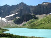
Maybe the weekend. Iceberg Lake/Shangrila sounds cool to me for the weekend
pocketlint
http://forecast.weather.gov/MapClick.ph ... dMFuUnnaP8
I dunno what it's like in the park but it's been hot here in Whitefish for a couple days and more of this to come.
Maybe the weekend. Iceberg Lake/Shangrila sounds cool to me for the weekend
pocketlint
http://forecast.weather.gov/MapClick.ph ... dMFuUnnaP8
-
davidwayne
- Posts: 135
- Joined: Tue Jan 06, 2009 11:36 am
- Gender?: Male
- Please add the numbers(11): 11
- Location: Bryan, Texas
- Has thanked: 15 times
- Been thanked: 6 times
-
Pocketlint
Re: Weather change this week
That thermometer sensor is being faked out by something. Heat trapped in housing. Reflected heat from something in or around the housing. Something. US Weather Service has it 81F at the Two Med Bridge on US 2 AEast Glacier.davidwayne wrote:Two Medicine cam now shows a temperature of 105 degrees?!
I doubt there is a 24F differential between E. Glacier and Two Med on a day like today. Possible, I suppose, but highly unlikely imho.
pocketlint
-
Stmarypete
- Donator

- Posts: 347
- Joined: Sat Jul 21, 2012 8:45 pm
- Gender?: Male
- Please add the numbers(11): 11
- Location: Lewiston Idaho
Re: Weather change this week
I am sure the cam is right! I live in Lewiston Idaho and it is currently 98, so damn sure that GNP at 4500 ft is at least 15 degrees hotter.
-
Pocketlint
Re: Weather change this week
I still don't think it got to 105 at Two Med...based on this 3 day chart of temps at Two Med Bridge in E Glacier which incidently is 4751 ft.
http://www.wrh.noaa.gov/mesowest/getobe ... m=72&raw=0
Te road temperature was only just above a 100F
pocketlint
http://www.wrh.noaa.gov/mesowest/getobe ... m=72&raw=0
Te road temperature was only just above a 100F
pocketlint
-
Fairbanks142
- Donator
- Posts: 194
- Joined: Sun Jan 01, 2012 1:14 pm
- Gender?: Male
- Please add the numbers(11): 11
Re: Weather change this week
Just checked the 10 day forecast for Apgar. High of 91 today. Toasty. Not much in the way of rain forecasted for the next 10 days either.
At least the high temps drop starting tomorrow -- highs around 80 through the weekend.
At least the high temps drop starting tomorrow -- highs around 80 through the weekend.
-
Pocketlint
Re: Weather change this week
Here's the forecast through the weekend for the Flathead followed by St Mary
000
FXUS65 KMSO 172013
AFDMSO
Area Forecast Discussion
National Weather Service Missoula MT
213 PM MDT Wed Jul 17 2013
...Very HOT and Dry conditions Thursday through Monday...
.DISCUSSION...Thunderstorms are developing over the region with a
weak storm system moving over northwest Montana. Some of these
thunderstorms may produce local heavy rain, hail and wind gusts to
50 mph. Check out our twitter feed for real-time information of
location and intensity of storms. Convection will end later this
evening as a drier airmass and high pressure move into the region.
Thursday through Sunday...High pressure will persist through the
weekend resulting in very hot temperatures and dry conditions.
Forecast highs:
Thursday and Friday...Mid 90s
Saturday and Sunday...Mid and upper 90s.
90 plus degree weather will continue through the middle of next
week. One possible change to the region may be a brief flattening
of the ridge on Monday or Tuesday which could increase west winds
and pose a potential fire weather impact. Confidence is low right
now for this scenario as little agreement exists among the current
weather models.
&&
=========================================================================
000
FXUS65 KTFX 172303
AFDTFX
AREA FORECAST DISCUSSION
NATIONAL WEATHER SERVICE GREAT FALLS MT
503 PM MDT Wed Jul 17 2013
.DISCUSSION...
Tonight through Friday...Convective activity getting started this
afternoon with thunderstorms rapidly developing over west and
southwest Montana in response to an upper trof moving across
northwest Montana and into southern Alberta along with jet streak
energy. Convective parameters are not overly impressive but strong
to severe storms are possible. Additionally, precipitable water
values are very high across the area and may translate to heavy rain
with some storms. Convective activity should end after midnight with
an upper ridge rebuilding over the area Thursday. With a stronger
westerly flow aloft on Thursday, along with favorable mixing,
surface winds will become breezy during the afternoon. As the ridge
axis retrogrades a little to the west on Friday, northwest flow
aloft will develop over the area but conditions will remain dry.
Temperatures will warm to above seasonal averages through the
period. Emanuel
Friday night through Wednesday...Models appear to be in decent
agreement for the early portion of the medium range period. The
weekend starts off with a broad upper level ridge centered over
Nevada and the associated ridge axis extending into British
Columbia. Models indicate that the core of the high pressure system
will move to the California coast while shortwave energy moving over
the top of the ridge brings a dry west to northwest flow aloft to
Montana by Sunday night. Models differ on the strength of this
shortwave but both agree that the airmass will remain dry during
this period. Model solutions diverge beyond the weekend with the GFS
rebuilding the ridge over the Northern Rocky Mountains while the
ECMWF keeps high pressure over the Eastern Pacific and nearly zonal
flow aloft over Montana. Despite these differences in upper air
patterns both models remain dry and warm through the middle of next
week. Have made only minor temperatures to the going forecast for
what appears to be shaping up as a relatively quiet mid summer. mpj
&&
.AVIATION...
UPDATED 2302Z.
Scattered showers and thunderstorms will move east and diminish
during the evening...most storms should be east of KLWT by 08z. Some
storms could have large hail and gusty winds. Dry conditions will
continue through Thursday. MVFR conditions are possible near showers
and thunderstorms this evening...elsewhere VFR conditions will
prevail through the next 24 hours.
&&
.FIRE WEATHER...
Widespread rain and thunderstorms are possible this afternoon and
evening as ample monsoonal moisture, instability and wind shear
combined with an upper-level disturbance move over the forecast
area. Some storms may be strong to severe with strong erratic
winds, hail and locally heavy rainfall, however confidence remains
low with regards to heavy rainfall location and coverage. Over
recent burn areas, heavy rain could cause rapid runoff and/or
debris flows. With better chances of widespread thunderstorms, the
threat for lightning- induced fire starts will increase with
holdover ignitions possibly triggering some fires later in the
week.
000
FXUS65 KMSO 172013
AFDMSO
Area Forecast Discussion
National Weather Service Missoula MT
213 PM MDT Wed Jul 17 2013
...Very HOT and Dry conditions Thursday through Monday...
.DISCUSSION...Thunderstorms are developing over the region with a
weak storm system moving over northwest Montana. Some of these
thunderstorms may produce local heavy rain, hail and wind gusts to
50 mph. Check out our twitter feed for real-time information of
location and intensity of storms. Convection will end later this
evening as a drier airmass and high pressure move into the region.
Thursday through Sunday...High pressure will persist through the
weekend resulting in very hot temperatures and dry conditions.
Forecast highs:
Thursday and Friday...Mid 90s
Saturday and Sunday...Mid and upper 90s.
90 plus degree weather will continue through the middle of next
week. One possible change to the region may be a brief flattening
of the ridge on Monday or Tuesday which could increase west winds
and pose a potential fire weather impact. Confidence is low right
now for this scenario as little agreement exists among the current
weather models.
&&
=========================================================================
000
FXUS65 KTFX 172303
AFDTFX
AREA FORECAST DISCUSSION
NATIONAL WEATHER SERVICE GREAT FALLS MT
503 PM MDT Wed Jul 17 2013
.DISCUSSION...
Tonight through Friday...Convective activity getting started this
afternoon with thunderstorms rapidly developing over west and
southwest Montana in response to an upper trof moving across
northwest Montana and into southern Alberta along with jet streak
energy. Convective parameters are not overly impressive but strong
to severe storms are possible. Additionally, precipitable water
values are very high across the area and may translate to heavy rain
with some storms. Convective activity should end after midnight with
an upper ridge rebuilding over the area Thursday. With a stronger
westerly flow aloft on Thursday, along with favorable mixing,
surface winds will become breezy during the afternoon. As the ridge
axis retrogrades a little to the west on Friday, northwest flow
aloft will develop over the area but conditions will remain dry.
Temperatures will warm to above seasonal averages through the
period. Emanuel
Friday night through Wednesday...Models appear to be in decent
agreement for the early portion of the medium range period. The
weekend starts off with a broad upper level ridge centered over
Nevada and the associated ridge axis extending into British
Columbia. Models indicate that the core of the high pressure system
will move to the California coast while shortwave energy moving over
the top of the ridge brings a dry west to northwest flow aloft to
Montana by Sunday night. Models differ on the strength of this
shortwave but both agree that the airmass will remain dry during
this period. Model solutions diverge beyond the weekend with the GFS
rebuilding the ridge over the Northern Rocky Mountains while the
ECMWF keeps high pressure over the Eastern Pacific and nearly zonal
flow aloft over Montana. Despite these differences in upper air
patterns both models remain dry and warm through the middle of next
week. Have made only minor temperatures to the going forecast for
what appears to be shaping up as a relatively quiet mid summer. mpj
&&
.AVIATION...
UPDATED 2302Z.
Scattered showers and thunderstorms will move east and diminish
during the evening...most storms should be east of KLWT by 08z. Some
storms could have large hail and gusty winds. Dry conditions will
continue through Thursday. MVFR conditions are possible near showers
and thunderstorms this evening...elsewhere VFR conditions will
prevail through the next 24 hours.
&&
.FIRE WEATHER...
Widespread rain and thunderstorms are possible this afternoon and
evening as ample monsoonal moisture, instability and wind shear
combined with an upper-level disturbance move over the forecast
area. Some storms may be strong to severe with strong erratic
winds, hail and locally heavy rainfall, however confidence remains
low with regards to heavy rainfall location and coverage. Over
recent burn areas, heavy rain could cause rapid runoff and/or
debris flows. With better chances of widespread thunderstorms, the
threat for lightning- induced fire starts will increase with
holdover ignitions possibly triggering some fires later in the
week.
-
Pocketlint
Re: Weather change this week
Gonna be a HOT one tomorrow doing Siyeh with Toddnick and company.
000
FXUS65 KMSO 190932
AFDMSO
Area Forecast Discussion
National Weather Service Missoula MT
332 AM MDT Fri Jul 19 2013
.DISCUSSION...Not many new details to mention during this ongoing
hot, dry weather pattern. High pressure will remain locked firmly
over the Northern Rockies through at least next week, with
temperatures staying between 90 to 100 degrees. Some of the
driest air so far this summer will occur over the next several
days, which could exacerbate current wildfires burning across the
region.
Expect hot and dry conditions to endure through the weekend and
into next week. Little to no precipitation is expected.
&&
pocketlint
-
Tsmith
- Posts: 686
- Joined: Wed Jun 06, 2007 10:53 am
- Gender?: Male
- Please add the numbers(11): 11
- Location: South, MS - flying from MSY
- Contact:
Re: Weather change this week
Well I hope it gets pushed out for the week after that ...through at least next week
Visit my Glacier NP Photo Gallery and leave comments if you like, thanks!
-
Ear Mountain

- Moderator & 2.1 Donator

- Posts: 4982
- Joined: Fri Jun 22, 2007 9:53 pm
- Gender?: Male
- Please add the numbers(11): 11
- Location: Choteau, Montana
- Has thanked: 38 times
- Been thanked: 42 times
- Contact:
Re: Weather change this week
Typical Montana Forecast:
The weather will be like this until its different.
The weather will be like this until its different.
Text and photos Copyright 2007-2023.
Re: Weather change this week
w appologies to the folks in the backcountry, really glad to see the rain and cooler temps.
if you don't like the weather, wait 10 minutes.
if you don't like the weather, wait 10 minutes.
-
Ear Mountain
- Moderator & 2.1 Donator
- Posts: 4982
- Joined: Fri Jun 22, 2007 9:53 pm
- Gender?: Male
- Please add the numbers(11): 11
- Location: Choteau, Montana
- Has thanked: 38 times
- Been thanked: 42 times
- Contact:
Re: Weather change this week
It's still summer and most likely the rainy period will not last too long. But as Scott says, the moisture will do some good and it might calm the Red Shale Fire some which is smoking out the mountains on the Front west of Choteau.scott-atl wrote:w appologies to the folks in the backcountry, really glad to see the rain and cooler temps.
if you don't like the weather, wait 10 minutes.
Text and photos Copyright 2007-2023.
-
Tsmith
- Posts: 686
- Joined: Wed Jun 06, 2007 10:53 am
- Gender?: Male
- Please add the numbers(11): 11
- Location: South, MS - flying from MSY
- Contact:
Re: Weather change this week
Ralph, is the rain today doing anything for the area associated with the Red Shale Fire?Ear Mountain wrote:It's still summer and most likely the rainy period will not last too long. But as Scott says, the moisture will do some good and it might calm the Red Shale Fire some which is smoking out the mountains on the Front west of Choteau.scott-atl wrote:w appologies to the folks in the backcountry, really glad to see the rain and cooler temps.
if you don't like the weather, wait 10 minutes.
Visit my Glacier NP Photo Gallery and leave comments if you like, thanks!